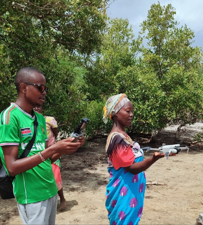

In the fight against environmental degradation, innovative solutions are continually sought to monitor and restore ecosystems effectively. Through our commitment to empower local communities and conserving degraded mangrove ecosystems, we embarked on a pioneering initiative utilizing drone technology to monitor both planted and degraded sites in its restoration projects.
Mangroves, with their vital ecological functions and economic benefits, play a crucial role in coastal regions worldwide. However, due to factors such as deforestation, urbanization, and climate change, mangrove ecosystems are under threat. Recognizing the urgency of the situation, we have implemented a multifaceted approach to mangrove restoration, with a key focus on community involvement and technological innovation.
Our restoration projects are situated in several creeks across coastal regions, where mangrove degradation is prevalent. By partnering with local communities, we ensure that restoration efforts are not only sustainable but also culturally relevant and economically beneficial to those directly affected by the decline of mangrove ecosystems.
One of the challenges faced in mangrove restoration is the effective monitoring of both planted sites and degraded areas earmarked for restoration. Traditional monitoring methods often prove time-consuming, labor-intensive, and sometimes inaccurate. This is where drone technology emerges as a game-changer for us.
Drones, equipped with high-resolution cameras and advanced mapping software, provide us with real-time aerial imagery of restoration sites. This imagery enables precise monitoring of mangrove growth, health, and spatial distribution. By regularly surveying planted sites, er can assess the effectiveness of restoration efforts, identify areas requiring additional attention, and adjust strategies accordingly.
Moreover, drones facilitate the monitoring of degraded sites earmarked for restoration. Through aerial surveys, we gain valuable insights into the extent of degradation, allowing for informed decision-making regarding intervention strategies. These insights include identifying areas with the highest potential for natural regeneration, assessing the feasibility of restoration activities, and determining optimal planting locations.
The integration of drone technology into our restoration projects not only enhances monitoring capabilities but also contributes to data-driven decision-making and resource optimization. By streamlining monitoring processes, we can allocate resources more efficiently, prioritize areas in urgent need of restoration, and evaluate the long-term impact of its conservation efforts.
Commenti (0)
Lascia un commento